GTA 6 Map: Leonida, Vice City, Locations, Size & GTA 5 Comparison
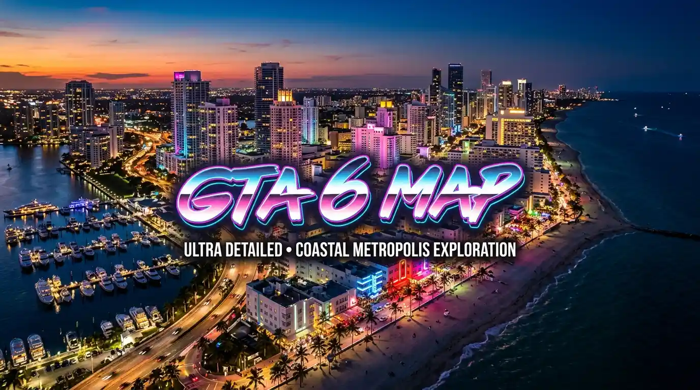
GTA 6 takes place in the fictional state of Leonida, with Vice City as its main city. Rockstar has officially revealed several surrounding areas, including the Leonida Keys, Grassrivers, Port Gellhorn, Ambrosia and Mount Kalaga National Park. Rockstar has not released a complete official map or exact km² figure yet.
Rockstar has confirmed that GTA 6 takes place in Leonida, a fictional state inspired by Florida, with Vice City as its main city. Several additional regions have also been revealed through Rockstar's trailers and promotional material.
The currently confirmed major areas are:
| GTA 6 Region | Status | Description |
|---|---|---|
| Vice City | Confirmed | The main urban center of GTA 6 |
| Leonida Keys | Confirmed | Tropical islands and coastal areas |
| Grassrivers | Confirmed | Wetland and swamp environment |
| Port Gellhorn | Confirmed | Coastal area on Leonida's forgotten coast |
| Ambrosia | Confirmed | Rural and industrial area |
| Mount Kalaga National Park | Confirmed | Natural and mountainous region |
These locations form the core of the currently known GTA 6 map. The exact roads, boundaries and smaller points of interest may continue to change as Rockstar reveals more information.
The GTA 6 map contains a mixture of cities, towns, islands, wetlands, coastal areas and natural environments. Some locations have been officially revealed by Rockstar, while others have been identified through community mapping and trailer analysis.
GTA 6 Confirmed Locations
| Location | Type | Status |
|---|---|---|
| Vice City | City | Confirmed |
| Leonida Keys | Island region | Confirmed |
| Grassrivers | Wetlands | Confirmed |
| Port Gellhorn | Coastal town/region | Confirmed |
| Ambrosia | Town/region | Confirmed |
| Mount Kalaga National Park | National park | Confirmed |
Other locations and landmarks have appeared in trailers, screenshots and promotional material, but their exact position or status may not always be officially confirmed. For that reason, this map distinguishes confirmed information from community mapping and speculation.
Vice City is the main confirmed city in GTA 6. The game is set in the wider fictional state of Leonida, meaning the GTA 6 map extends beyond the main city into smaller towns, islands, wetlands and rural areas.
What is the GTA 6 city called?
The main city is Vice City, Rockstar's fictional interpretation of Miami.
Is Vice City the only city in GTA 6?
Vice City is the central and most prominent city revealed so far. However, the wider Leonida map contains other towns and developed areas, including Port Gellhorn and Ambrosia.
| GTA 6 City / Area | Status |
|---|---|
| Vice City | Confirmed |
| Port Gellhorn | Confirmed |
| Ambrosia | Confirmed |
| Other towns and settlements | Additional locations may be revealed |
The distinction between a city, town, region and community-mapped location is important because not every named area on fan-made GTA 6 maps has been officially classified by Rockstar.
Rockstar has not published an exact square-kilometer figure for the GTA 6 map. As a result, exact numbers circulating online should be treated as community estimates rather than an official measurement. The safest way to compare the map is by using the comparisons reported for GTA 6 against previous Rockstar open-world games.
| Map | Size Information |
|---|---|
| GTA 6 | Exact official area not published |
| GTA 5 | Previous GTA benchmark |
| Red Dead Redemption 2 | Previous Rockstar open-world comparison |
| GTA 6 vs GTA 5 | Reported as substantially larger |
Community mapping projects have produced different estimates based on trailer footage, screenshots and leaked material. Because these calculations can change as more of the world becomes known, we do not treat an exact km² number as officially confirmed.
Is GTA 6 bigger than GTA 5?
Yes. Current information indicates that GTA 6 has a substantially larger world than GTA 5, although Rockstar has not released an official square-kilometer measurement.
- December 2023 — Trailer 1 confirms the return to Vice City and the state of Leonida.
- May 2025 — Trailer 2 expands the map picture with new regions, character bios, and a first look at the Leonida Keys apartment where Jason and Lucia's story begins.
- November 2025 — Rockstar locks the release window, later refined to a firm date.
- May 2026 — Release date shifts to May 26, 2026, then pushed again.
- June 18, 2026 — Official cover art revealed, kicking off the marketing push.
- June 25, 2026 — Pre-orders open for PS5 and Xbox Series X|S.
- Current window — November 19, 2026 launch date, described by Take-Two as locked into its official financial guidance, with a third trailer still unannounced.
Vice City sits inside what the community refers to as Vice-Dale County, a clear nod to Miami-Dade County. It's built as a dense, walkable metropolis blending Art Deco beachfront hotels, glass downtown towers, and working-class neighborhoods, rather than one generic "big city" template.
Neighborhoods and districts spotted so far within Vice City include beachfront strips inspired by South Beach, a Little Havana–style district, an area resembling Miami's Wynwood arts district, waterfront islands modeled on Miami's Venetian Islands, and a working port and international airport. Rockstar has also shown a functional tram system that connects directly to the airport, along with sports venues including a stadium and an amphitheater.
What sets this Vice City apart from GTA 5's Los Santos is how seamlessly it blends into the surrounding countryside. Trailer footage suggests you can drive from downtown Vice City straight into small coastal towns, swampland, or highway sprawl without a single loading transition — a tighter, more organic city-to-country flow than previous GTA maps.
This remains the single most-asked question, and Rockstar has stayed deliberately quiet on it. There's no official square-kilometer or square-mile figure, and no downloadable world map from Rockstar itself.
Community mapping groups most notably the long-running GTA VI mapping community and independent trailer analysts have converged on an estimate of roughly 110–150 km² of explorable land, generally cited as 2 to 3 times the size of GTA V's San Andreas. Some individual community comparisons, built by overlaying leaked map fragments directly onto the GTA V map, have put the increase closer to 70% larger rather than a full doubling a reminder that even within the fan community, estimates vary depending on the source material used.
A retail listing that briefly appeared on Amazon Brazil in mid-2026 described the map only as "larger," covering Vice City, beaches, swamps, small towns, and various regions of Leonida, without giving a number. Until Rockstar releases an official figure most likely at or after launch every size claim online, including the ones in this article, should be read as an estimate.
GTA 6 moves away from GTA 5's San Andreas setting and introduces the fictional state of Leonida, centered around Vice City.
| Feature | GTA 5 | GTA 6 |
|---|---|---|
| Main city | Los Santos | Vice City |
| Fictional state | San Andreas | Leonida |
| Real-world inspiration | Southern California | Florida |
| Environment | City, desert, mountains and countryside | Coast, wetlands, islands, towns and countryside |
| Map status | Fully released | Pre-release |
| Full official map | Available in-game | Not released before launch |
The biggest difference is the variety of environments. GTA 6 combines the dense urban environment of Vice City with coastal islands, wetlands, rural areas and other regions across Leonida.
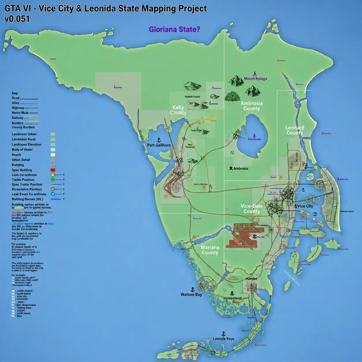
The GTA 6 mapping community has attempted to divide Leonida into county-style regions using road signs, environmental clues, landmarks and other details visible in GTA 6 footage. These county names and boundaries should not be treated as officially confirmed Rockstar information unless Rockstar directly confirms them.
| Community-Mapped County | General Area | Status |
|---|---|---|
| Vice-Dale County | Vice City area | Community interpretation |
| Leonard County | Eastern Leonida | Community interpretation |
| Ambrosia County | Northeast Leonida | Community interpretation |
| Kelly County | Northwest Leonida | Community interpretation |
| Mariana County | Southwest Leonida | Community interpretation |
These regions are useful for organizing the community's understanding of the GTA 6 map, but their exact boundaries may change as new official information becomes available.
Vice-Dale County Southeast Leonida
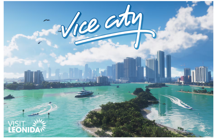
Vice-Dale County is centered around Vice City and represents the most heavily developed urban area of the GTA 6 map. The region features dense city streets, beaches, waterways, residential neighborhoods, entertainment districts, ports, and major transportation hubs. Locations associated with this area include Vice Beach, Ocean Beach, Little Havana, the Venetian Islands, Vice City Port, and Vice City International Airport. The overall environment draws heavily from South Florida, giving Vice City a mixture of high-rise buildings, tropical vegetation, nightlife, highways, and coastal neighborhoods.
Leonard County — Eastern Leonida
Leonard County is one of the regions identified through environmental details and road signage seen in GTA 6 footage. The area is believed to take inspiration from Florida's Broward County and appears to provide a transition between the dense urban environment of Vice City and the less-developed areas of Leonida. Waning Sands is one of the locations associated with this region. Compared with central Vice City, Leonard County appears to feature more open roads, suburban areas, and coastal landscapes.
Ambrosia County Northeast Leonida
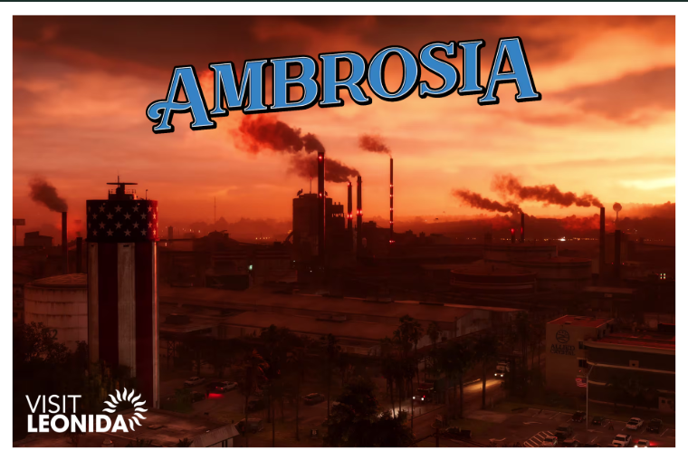
Ambrosia County occupies a more rural and industrial section of the GTA 6 map. The region is associated with agriculture, industrial facilities, and sugar production, giving it a noticeably different atmosphere from Vice City. The town of Ambrosia and the large Lake Leonida are among the notable locations connected with this area. Its landscape is expected to include farmland, industrial sites, smaller communities, and long stretches of roads connecting different parts of the county.
Kelly County — Northwest Leonida
Kelly County covers part of the northwestern side of Leonida and is home to Port Gellhorn, a coastal town with a more rundown and industrial atmosphere. Rockstar has described Port Gellhorn as part of Leonida's “forgotten coast,” highlighting its contrast with the wealthier and more glamorous areas around Vice City. The region appears to feature older buildings, industrial locations, coastal roads, and less-developed communities, giving players a very different environment to explore.
Mariana County — Southwest Leonida
Mariana County represents the tropical southern portion of the GTA 6 map. The area is associated with wetlands, islands, waterways, and tropical landscapes, making it one of the most visually distinctive parts of Leonida. The Grassrivers wetlands and Leonida Keys are important areas connected with this southern region. Its geography should provide a major contrast to the dense streets of Vice City, with more water-based exploration and natural environments.
Grassrivers
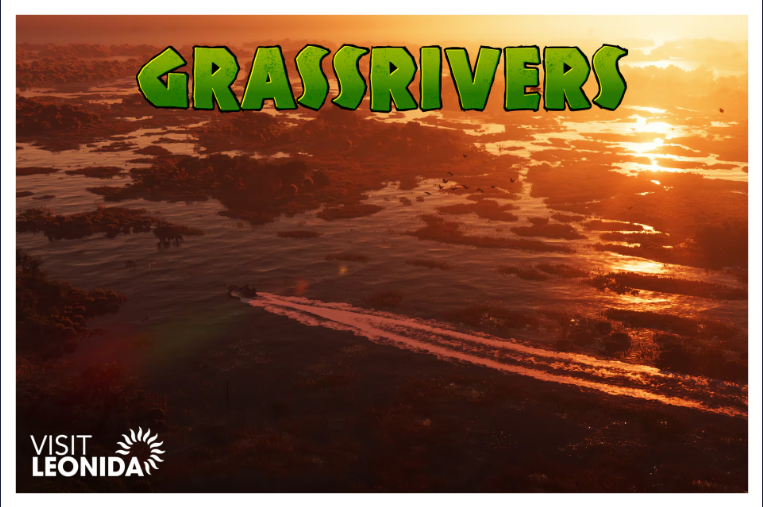
Grassrivers is a large wetland region inspired by the real-world Everglades of South Florida. The area features swampy waterways, dense vegetation, wildlife, and remote locations that are difficult to reach by conventional vehicles. Airboats and other water-based transportation are particularly suited to this environment. The wetlands also create opportunities for hidden locations, isolated properties, wildlife encounters, and exploration away from the main roads.
Leonida Keys
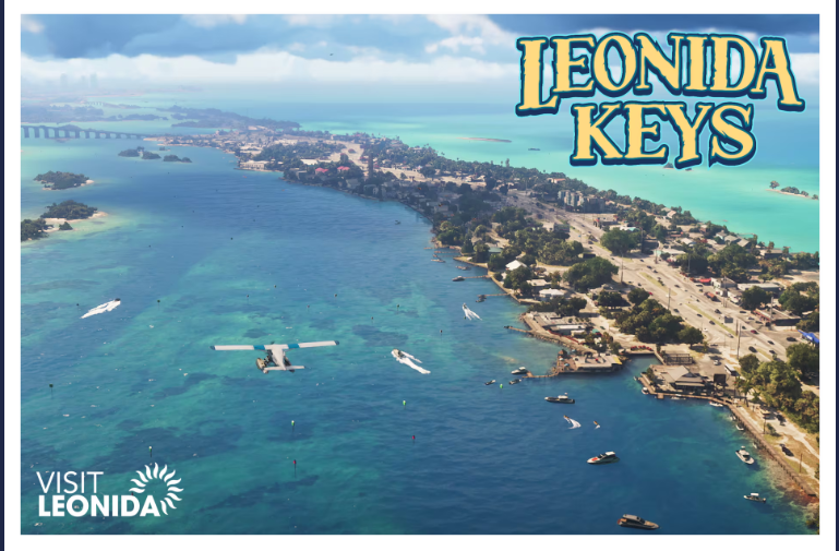
The Leonida Keys are a tropical island chain located in the southern part of the state. They are clearly inspired by Florida's real-world Florida Keys and provide a strong coastal contrast to the mainland areas of Leonida. The region includes small islands, bridges, waterways, beaches, tropical vegetation, and coastal communities. Trailer footage has also shown the protagonists in locations connected with this island region, making the Leonida Keys an important part of the GTA 6 map.
Mount Kalaga National Park
Mount Kalaga National Park occupies a more natural and rugged area in northern Leonida. Unlike Vice City's urban streets and the southern wetlands, this region features forests, elevated terrain, rocky landscapes, and canyon-like environments. Its scenery appears to draw inspiration from northern Florida and parts of the southeastern United States. The national park should provide players with a more wilderness-focused area for exploration, driving, and outdoor activities.
Other GTA 6 Map Locations
Beyond the major regions above, trailers and promotional material have revealed or hinted at several additional locations and landmarks across Leonida. These include Yorktown, the Malibu Club, military facilities, coastal settlements, bridges, highways, and a monument referred to as the Monument of Leonida. As Rockstar continues to reveal more information about GTA 6, additional locations and map details may be confirmed.
Because some county names and regional boundaries have been reconstructed by the GTA 6 mapping community rather than officially published by Rockstar, they should be treated as mapping interpretations until Rockstar confirms them directly. This distinction is especially important when comparing the official GTA 6 map with community mapping projects and unofficial interactive maps.
Is there a second state — Gloriana?
License plates visible in Trailer 2 and promotional screenshots reference a second state called Gloriana, believed to be inspired by Georgia and positioned north of Mount Kalaga. It's unconfirmed whether Gloriana will be a physically explorable part of the map or purely a background detail on vehicle plates. Rockstar's marketing has also repeatedly referenced Liberty City as Lucia's hometown, though it remains unclear whether it will appear as a playable location or only as backstory.
It's worth being precise about three very different things people mean when they search for "the GTA 6 map":
- Official map —What Rockstar itself has confirmed: the state name, Vice City, and the handful of named regions above. Rockstar has not released a complete, official world map image.
- Community mapping renditions — Detailed reconstructions built by long-running fan mapping projects, combining trailer analysis, screenshots, road signage, and the 2022 leak. These are unofficial but often impressively close to the mark, the same way GTA 5's map was largely reconstructed by fans before launch.
- Leaked footage — The 2022 gameplay leak gave an early, unpolished look at parts of the map, but Rockstar has continued refining the game since then, so leak-based details shouldn't be treated as final.
Until Rockstar ships the game, any "full map" circulating online is a fan reconstruction, not an official Rockstar asset.
An interactive map lets you click through Leonida location by location instead of squinting at a static image — toggling icons for cities, landmarks, businesses, and points of interest. Community-built interactive maps already exist, assembled from confirmed regions and trailer analysis, and they're updated every time Rockstar reveals something new. Expect icon categories to eventually include:
- Cities, towns, and county boundaries
- Landmarks and points of interest
- Shops and businesses seen in trailers
- Roads, transit lines, and the Vice City tram/airport link
- Collectibles and mission markers (once the game is actually playable)
A fully accurate version with real roads, missions, and collectibles will only be possible once GTA 6 launches on November 19, 2026.
"Mapping project" refers to the ongoing community effort to reconstruct Leonida before release. Dedicated groups including long-running Discord mapping communities and individual creators on Reddit cross-reference every trailer frame, screenshot, road sign, and license plate against the 2022 leak to estimate roads, county borders, and coastlines. Several independent renditions now exist, built by different community groups working from the same source material, and they largely agree on the broad shape of Leonida even where fine details differ.
This mirrors what happened before GTA V's release, when a GTAForums-led mapping project reconstructed Los Santos from screenshots alone and turned out to be remarkably accurate once the game launched which is part of why the current GTA 6 mapping efforts are taken fairly seriously.
It's still worth repeating: these are fan projects, not Rockstar products, and their size and layout estimates should be treated as informed guesses.
Once interactive maps mature both fan-made now and official after launch expect icon layers for shops, activities, missions, collectibles, and points of interest. Right now, most "map with icons" versions online are built on confirmed region names plus placeholder markers from community mapping projects; full accuracy arrives after release, once every interior, shop, and mission location can actually be logged in-game.
GTA 6 Online Map
Rockstar hasn't confirmed specific map details for a GTA 6 Online mode. The most reasonable expectation, based on how GTA Online expanded on GTA 5's map after 2013, is that online play will launch on the same Leonida map as the story mode, with online-exclusive additions layered in over time. Treat anything more specific than that as speculation for now.
One angle competitors rarely dig into: Rockstar has already signaled that GTA 6's world isn't necessarily "finished" at launch. The project was originally planned under the codename "Project Americas" with an even larger scope spanning multiple regions, before being scaled back to focus on Leonida with deeper interiors instead.
Rockstar has since indicated it intends to keep expanding the game's world after release, adding new locations and content over time rather than front-loading everything into day one a shift tied to changes in the studio's development culture aimed at reducing crunch.
That's led to comparisons with live-service games that evolve their maps season to season. Nothing here is confirmed as a specific roadmap, and it's a meaningfully different model from a traditional GTA expansion pack, so it's best treated as a plausible direction rather than a promise but it does suggest the "final" size and shape of the GTA 6 map might not be locked in even after November 19.
What is the GTA 6 map called?
The GTA 6 map is set in the fictional state of Leonida, with Vice City as its main urban center. Leonida includes beaches, islands, wetlands, rural areas, smaller communities and other locations inspired by Florida.
What city is GTA 6 set in?
GTA 6 is primarily set in Vice City, a fictional version of Miami. The city is surrounded by the wider state of Leonida, which includes coastal areas, islands, countryside, wetlands and several smaller communities.
Is there an official GTA 6 map?
Rockstar has officially revealed several parts of the GTA 6 world through trailers, screenshots and other promotional material. However, a complete official world map showing every road, location and boundary has not been released yet.
What locations are confirmed in GTA 6?
The major confirmed areas include Vice City, Leonida Keys, Grassrivers, Port Gellhorn, Ambrosia and Mount Kalaga National Park. These locations represent different environments, including beaches, wetlands, rural areas, coastal towns, islands and developed urban districts.
Is GTA 6 map bigger than GTA 5?
Yes. GTA 6 is expected to offer a significantly larger world than GTA 5. Rockstar has described Leonida as a huge open world, although an exact official square-kilometer measurement has not been published.
How big is the GTA 6 map?
Rockstar has not released an official square-kilometer measurement for the GTA 6 map. Community estimates vary because different projects use different sources, scaling methods and interpretations of the available trailer and mapping data.
What regions are in GTA 6?
The major revealed regions include Vice City, Leonida Keys, Grassrivers, Port Gellhorn, Ambrosia and Mount Kalaga National Park. Each area offers a different setting, ranging from urban districts and beaches to wetlands, islands, forests and rural landscapes.
Is Vice City the only city in GTA 6?
Vice City is the main confirmed city in GTA 6, but it is not the entire map. Leonida also includes smaller towns, settlements, coastal communities and developed areas that expand the world beyond Vice City.
What is Leonida in GTA 6?
Leonida is the fictional U.S. state where GTA 6 takes place. It is Rockstar's fictional interpretation of Florida, featuring Vice City alongside beaches, islands, wetlands, rural areas, highways and other distinct environments.
Is the GTA 6 interactive map official?
No. Pre-release interactive GTA 6 maps are community-made projects based on publicly revealed information, trailer details and mapping research. They should not be considered official Rockstar maps unless Rockstar directly publishes or confirms them.
Will the GTA 6 map change after release?
The final GTA 6 map can only be fully confirmed when the game releases. Rockstar may add new content after launch, but any future map expansions or locations should be considered unconfirmed until officially announced.